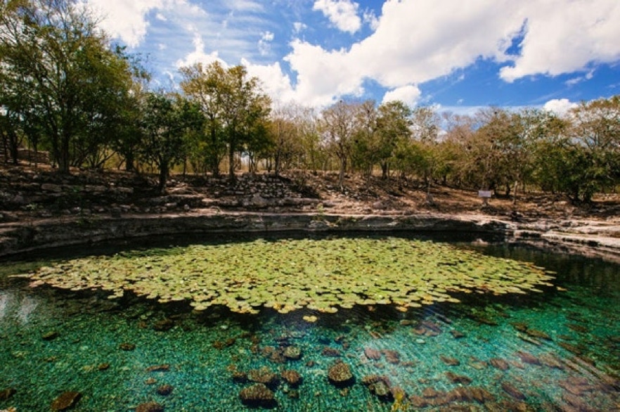
2. XLACAH CENOTE, DZIBILCHALTUN Dzibilchaltun's existence was in a sense fore-ordained by its geography on the border between the mangrove swamps, salt deposits and fishing and trading opportunities of the Gulf of Mexico, 20 miles away and the Yucatan's karst crust with just enough topsoil to raise a crop of corn. As important, the settlement was located at the Xlacah Cenote, the largest on the Peninsula, 200m x 150 m at the surface but 60m deep and stretching along a cavern at least 1.5km long. Its central role in the town's founding is attested by its name which means the "old town's sinkhole," providing both an abundant source of drinking water and ready access to the underworld and the supranatural. People of all social classes cast offerings, mostly pottery but also precious stones into its depths, (though there is an unusual lack of human remains.) Today the local Maya don't hesitate to use it as a swimming hole, nor do tourist sweltering after hours trudging along the city's unshaded, far-flung sacbeob plural of sacbe or "white way," named after its sandstone paving covered in lime.)